Circumnavigating Milne Land in Scoresbysund, East Greenland
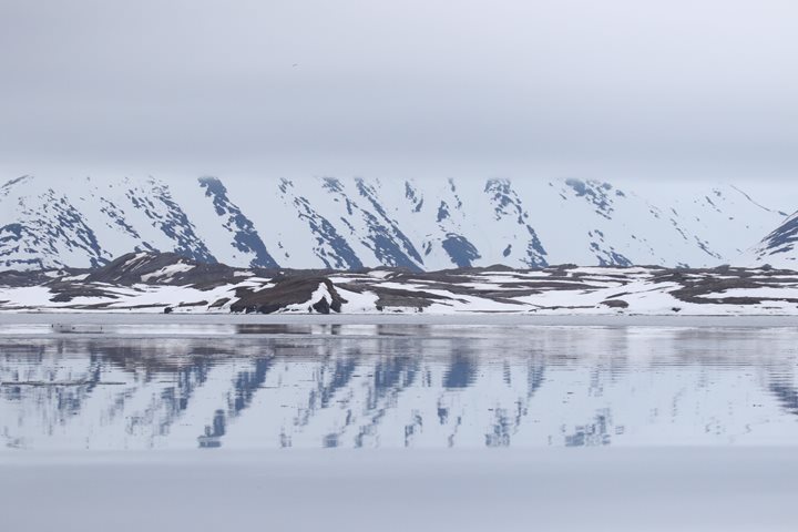
At six o´clock the National Geographic Explorer pulled anchor at Ankervig (Anchor Bay) and set course towards Rypefjord, which is located at the northwestern side of Milne Land. Some early risers were already in place with cameras on the observation deck. A variety of icebergs under a sunny, blue sky were mirrored by a perfectly calm sea. As breakfast was finished, a great number of guests went up to the bridge or came out on deck to view the magnificent fjord scenery on our way to the first landing of the day. Binoculars were actively used to spot wildlife as we cruised along Rødefjord (the Red Fjord). A few muskoxen were detected in the far distance. Only a glaucous gull here and there and a couple of seals were observed from the ship. However, floating icebergs and colorful rocky slopes alternating with a number of glaciers and waterfalls provided magnificent views of a pristine fjord landscape. Quite a few of the glaciers are so-called hanging glaciers which have lost much volume. This proves that there has been a substantial melt-off over the last decades.
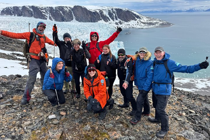
Most of our guests went ashore for hikes at the peninsula between Rypefjord (Ptarmigan Fjord) and Harefjord (Hare Fjord). The long- and medium hikers pushed uphill, whereas some guests enjoyed staying closer to the beach. We were blessed by the same warm weather that we had enjoyed over the last few days. We could therefore take off layers and walk comfortably even with shorts and a t-shirt. Just above the landing site we found the skull and also a complete skeleton of muskox. A few birds were spotted: ringed plover, a number of snow buntings and northern wheatear. One group of hikers observed 17 barnacle geese and three pink-footed geese on a small lake. Two muskoxen were spotted in the far distance behind the lake.
After lunch the ship cruised through narrow scenery in Øfjord (the Island Fjord). This is a long fjord between Renland and Milne Land. Øfjord was discovered and named by Carl Ryder´s expedition 1891-92 during the exploration of the Bjørnøer islands in September 1891. There are no islands within the main stretch of the fjord, and the name derives from the Bjørnøer group of islands at the fjord´s northeastern end. We were told that in 1963 some 27 muskoxen - 10 males and 17 females (all calves) - were caught with lasso in the area where we hiked. At first these animals were transported by a cargo ship to Copenhagen where they stayed through the winter and then were shipped to Kangerlussuaq in West Greenland, which at that time was a US air base.
In the afternoon National Geographic photographer Cotton Coulson and Global Perspective Guest Speaker David Wright gathered those interested in video for a video editing session: how to set up a good workflow, starting the edit, constructing the sequence and how to share your masterpieces with friends and family.
The evening recap included talks on photography, glacier dynamics and an introduction about Scoresbysund (Ittoqqortoormiit), an Inuit village that we plan to visit tomorrow.
Our head waiter Pepe welcomed us to a special Phillipino dinner which was much appreciated. The day was completed with one more outdoor activity at Sydkap (South Cape) in the late evening. Most guests preferred a Zodiac cruise in between huge icebergs, whereas some chose to go ashore for a short hike. The hikers found two huts just above the shoreline. The oldest hut was built as a cabin to be used by polar bear hunters and also for fishing Arctic char. The big house on the shore was built around 1958-60 by a Danish couple in Scoresbysund for the purpose of going fishing and enjoying life. They planned to spend a year there, but did not make it, because the lady thought it would be too lonely to stay in such a remote place. The little hut needs substantial repair, whereas the big house seems to be in good shape. This house is open and is mainly being used by locals from Scoresbysund village.
During the late evening the ship sailed into Hall Bredning (bay), and we could see a big number of huge icebergs from the inner part of the Scoresbysund fjord system. The distance from the mouth of Scoresbysund via Hall Bredning to the western point is 313 kilometers, a continuous stretch of water credited to be the longest and deepest fjord in the world. Today we felt extra fortunate to be aboard this year´s first expedition cruise ship to zig-zag between icebergs through such beautiful, narrow fjords in East Greenland.